
Everyone agrees that urban data shapes the future of cities—but few have quantified how much it actually matters. Data guides decisions on infrastructure, equity, and sustainability. Yet when error rates in urban datasets range from 0.02% to 28%, even small inaccuracies can distort billion-dollar policies. A 1% error in land-use or population data can skew infrastructure costs by 5–10%. IBM once estimated poor data quality costs the U.S. economy $3.1 trillion annually—local governments shoulder much of that through inefficient service delivery.
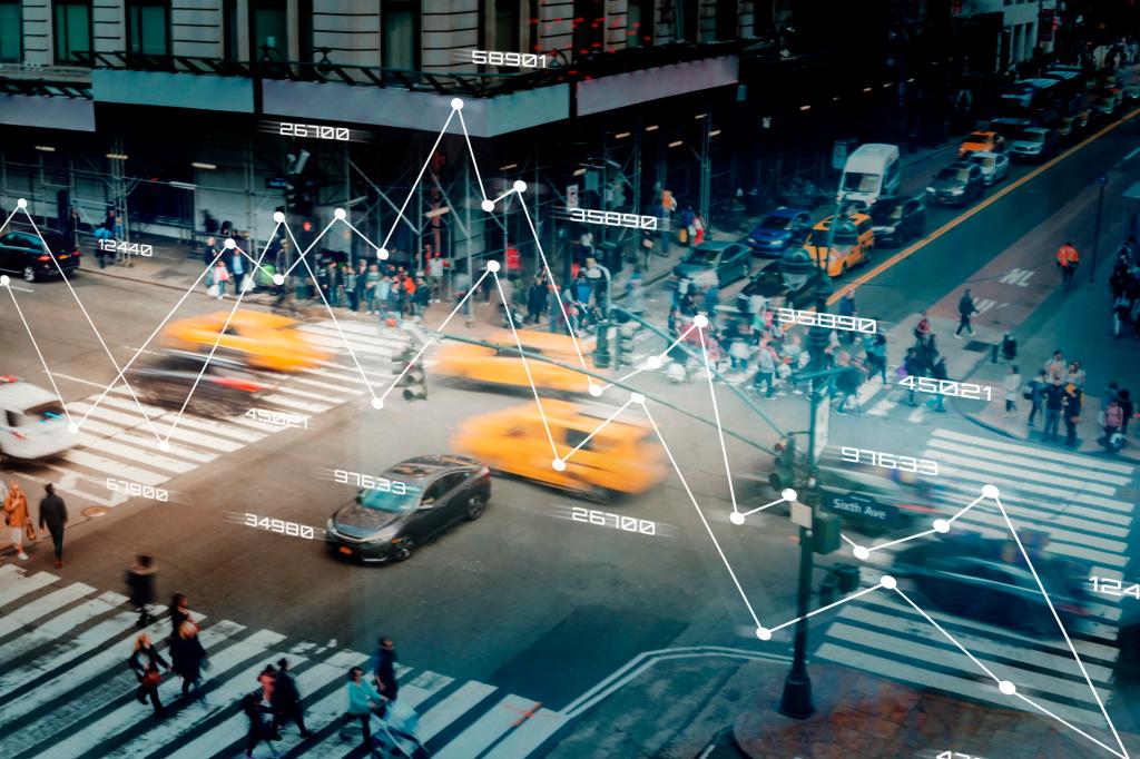
Urban data, at its core, is simply the story of city life told through numbers—demographics, environment, mobility, housing, economy, and governance. Today’s debates focus on big data—vast, complex, and fast-moving datasets that reveal patterns traditional tools can’t handle. But not all data is equal in quality or accessibility.
The Census remains the backbone of most urban datasets—its history traces back to Babylon in 3800 BCE, counting butter and livestock long before broadband and IoT. Modern censuses now map everything from income and housing to infrastructure and environment. Beyond it, hundreds of specialized datasets power urban research—from OpenStreetMap and NASA’s Landsat to NYC Open Data, OECD, and World Bank platforms.
Yet, despite the abundance, urban data remains fragmented. Up to 80% of city data systems are siloed (McKinsey, 2018), and over 60% of developing-country datasets are outdated (World Bank, 2020). Even when open portals exist, only about 30% of cities meet basic open-data standards (UN-Habitat, 2022). This means critical insights—on housing inequities, heat islands, or mobility patterns—are lost in translation between systems.
Accuracy is another weak link. Manual entry, outdated surveys, and inconsistent reporting introduce errors that ripple through policy. In the U.S., a 2–3% census undercount in urban minority populations directly affects federal funding allocation. These data gaps shape real consequences—misallocated budgets, flawed urban design, and ineffective climate adaptation.
The next phase of urban data must move beyond collection to integration, real-time tracking, and predictive analytics. Smart cities are already using IoT, AI, and satellite data to monitor air quality, traffic, and social mobility in real time. By 2030, the global market for smart city data platforms will exceed $60 billion, promising a more responsive and equitable model of governance.
But here’s the catch—it’s not enough. We’re improving data systems, but not at the speed cities are changing. Building accurate, complete, and accessible datasets is not a luxury; it’s a precondition for smarter, fairer urban decisions. Cities need a balanced approach—combining quantitative insights with human judgment, local knowledge, and attention to power dynamics—to build truly inclusive, resilient, and adaptive urban futures. Only by embracing both data and context can we make city decisions that genuinely serve all communities.
What’s your take on the state of urban data?
Share your thoughts below—let’s keep this conversation real, open, and data-driven.
Bonus
Data sets sources
Here’s a comprehensive list of common urban datasets and their key sources, grouped by thematic areas — useful for research, modeling, and policy analysis in urban planning and development:
🏙️ 1. Demographics & Socioeconomic Data
- U.S. Census Bureau – Decennial Census, American Community Survey (ACS)
- UN-Habitat Urban Indicators Database – Global urban metrics (density, services, housing)
- World Bank Open Data – Population, poverty, urbanization trends
- OECD Regional Statistics – Urban and regional economic data
- Eurostat Urban Audit – European city-level social and economic indicators
- National Statistical Offices – (e.g., Statistics Canada, Office for National Statistics UK, etc.)
🏗️ 2. Land Use, Zoning & Urban Form
- Local/Regional Planning Departments – Zoning maps, land-use parcels
- USGS (U.S. Geological Survey) – Land cover datasets (NLCD, Landsat imagery)
- OpenStreetMap (OSM) – Global building footprints, roads, amenities
- Global Human Settlement Layer (GHSL) – Urban extent and population density
- NASA MODIS & Landsat – Satellite-derived urban footprint and land cover change
- Copernicus Urban Atlas – Detailed European land-use datasets
🚗 3. Transportation & Mobility
- U.S. Department of Transportation (DOT) – Highway, transit, and freight data
- Federal Transit Administration (FTA) – Public transport performance and ridership
- GTFS Feeds – Open transit schedules (Google Transit Feed Specification)
- TomTom / HERE / INRIX / Apple Mobility Data – Real-time mobility and congestion
- Uber Movement – Travel times and speed distributions by city
- City Open Data Portals – E.g., NYC DOT, Transport for London (TfL), etc.
- National Household Travel Surveys (NHTS) – Travel behavior datasets
🌿 4. Environment, Climate & Sustainability
- EPA EnviroAtlas / AirNow / TRI – Air quality, toxic release, and environmental justice data
- NASA EarthData / NOAA Climate Data Records – Temperature, precipitation, sea level
- Global Urban Climate Database (GUC-D) – Urban heat island, greening indices
- WorldClim / Copernicus Climate Service – Climate projections at city scale
- ICLEI / C40 Cities / CDP Data Portal – City-level climate action and emissions data
- ESRI Living Atlas – Green infrastructure, water resources, floodplains
🏡 5. Housing, Real Estate & Land Markets
- HUD (U.S. Department of Housing and Urban Development) – AFFH, housing stock, affordability
- Zillow / Redfin / CoreLogic – Housing price indices and real estate trends
- Realtor.com Data Center – Rent and home value metrics
- ACS / Census Housing Data – Tenure, occupancy, housing quality
- Urban Observatory (UK / Global) – Housing and quality-of-life data
💰 6. Economic & Labor Market Data
- Bureau of Economic Analysis (BEA) – Regional GDP, industry composition
- Bureau of Labor Statistics (BLS) – Employment, wages, occupation by metro
- IMPLAN / REMI / Lightcast (formerly Emsi) – Economic impact and input-output data
- World Bank Enterprise Surveys – Business environment and productivity data
- OECD Metropolitan Database – Productivity, innovation, and labor markets
💡 7. Infrastructure, Utilities & Energy
- Department of Energy (DOE) – Energy consumption, building energy codes
- Open Energy Data Initiative (OEDI) – Renewable energy and grid data
- EPA Energy Star Portfolio Manager – Building efficiency benchmarking
- Municipal Open Data Platforms – Water, electricity, waste management data
- World Bank EnergyData.info – Global urban energy and infrastructure metrics
💬 8. Governance, Policy & Urban Finance
- World Cities Database / UN CityData Portal – Municipal finance and governance indicators
- OECD Metropolitan Governance Survey – Multi-level governance structures
- Open Government Data Portals (OGDP) – City budgets, permits, procurement
- IMF Fiscal Affairs Department – Urban fiscal capacity and expenditure data
- C40 / GCoM / ICLEI Reports – Policy actions, governance commitments
🛰️ 9. Geospatial & Remote Sensing Platforms
- Google Earth Engine – Massive geospatial datasets for urban analytics
- ESRI ArcGIS Hub – Local government geospatial data sharing
- NASA SEDAC (Socioeconomic Data and Applications Center) – Urban population and environment datasets
- Mapbox / Carto / Sentinel Hub – Geospatial visualization and analytics APIs
🌐 10. Open Urban Data Portals (Examples)
- Data.gov – U.S. national open data repository
- NYC Open Data – 3,000+ datasets across housing, transport, environment
- Chicago Data Portal – Urban operations and infrastructure data
- London Datastore – Demographics, energy, air quality, transport
- World Council on City Data (WCCD) – ISO 37120 certified global city indicators

Leave a comment